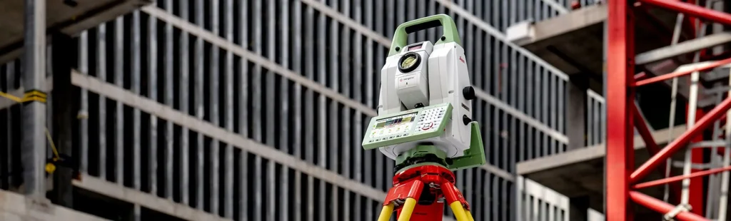
A total station is a theodolite with an integrated distance meter that can measure angles and distances simultaneously.
What is the difference between theodolite and total station?
Theodolites measure horizontal and vertical angles only. Sometimes they are called tachymeters because we can calculate distances using geometric – trigonometric calculations by angular measurement through a graduated sight. A theodolite can be mechanical or electronic. A total station can measure angles and distances electronically and process trigonometrically to give us, at a minimum, position coordinates in space.
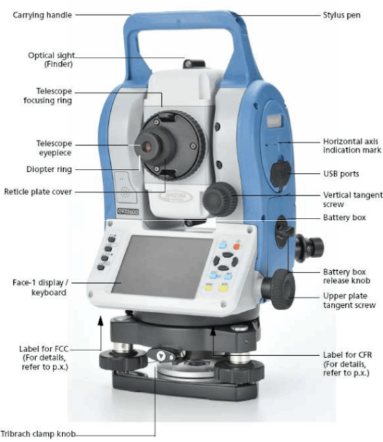
Nowadays, all electronic total stations have an electronic optical distance meter (EDM) and an electronic angle meter, so that the bar codes of the horizontal and vertical circle scales can be read, displaying the angles and distances values digitally. The horizontal distance, height difference and bearings are calculated automatically.
Used Leica Geosystems total stations are conceived for the purpose of determining the position and height of a point, or simply its position.
What is a total station used for?
- Assurance of pole tilt from a height
Assurance of pole tilt from a height or pointing on the ground, as well as reviewing a vertical line of a structure can be accurately done with a single face of the eyeglass, as long as it describes a completely vertical flat when turning it. This type of work requires a levelled second-hand total station to reduce the influence of vertical axis tilting.

- Surveying
When plotting a construction floor plan, point position and height are determined by measuring angles and distances. The instrument is placed on a point referred to a local coordinate system. For orientation purposes, a second point that is easy to distinguish is chosen after visaing it with the horizontal circle set to zero.

- Stakeout
To align a construction, it is useful to extrapolate the sides beyond the limits of the excavation, to determine the profiles of the limits on which stakes are placed. During the construction process, ropes or cables can be tied to these reference points to indicate the wall positioning.

- Automatic recognition of objectives
Leica Geosystems TCA reconditioned total stations features ATR objective recognition system. ATR recognition is achieved quickly and easily. Thanks to this technology it is possible to perform measurements automatically with a computer’s help. The most common application of this feature is the accurate controlling construction machinery guide. - Measure inaccessible distances (total TCR stations from Leica Geosystems)
TCR second-hand total stations of Leica Geosystems have a laser distance meter that does not require a reflector which is useful when you want to measure borders, place pipelines or in measurements along ravines or bars.
How many types of total stations are there?
- Used Manual Total Stations: measure medium and high precision. They are cost-effective and will help you to pay back the initial investment quicker.
- Used Robotic Total Stations: robotisation allows to optimise workforce since only one person is needed to do the job.
- Used Multistations: high-performance total stations including laser-scanner and image technology features.
How much is a total station?
Leica Geosystems used total stations can cost from 2,500€ up to 30,000€ depending on its features, functionalities and advanced technology.
Learn more about our used total stations and need some advice to choose which model is best for your tasks and projects, you can contact our sales dealers. We also offer training services. We can show you how to get your surveying equipment best performance.

Comments0